News
MNG: Utilising aerial LiDAR to assist with Malleefowl mound detection
31 August 2022
Recognised for its large nesting mounds, the Malleefowl (Leipoa ocellate) is a ground dwelling bird known as a megapode, native to the semi-arid areas of Australia. Generally found in woodlands and shrublands composed of eucalypt and acacia species, the species form nests up to four metres in diametre and a metre in height from leaf litter and soil.
Recent years have seen a significant decline in Malleefowl populations, and as such the species are now listed nationally as vulnerable, under the Environmental Protection and Biodiversity Conservation Act 1999 (EPBC Act). The main threat to the Malleefowl population has been habitat loss and fragmentation due to agriculture, mining, roads and inappropriate fire regimes.
A National Action Plan was introduced in 2007 to support the recovery of this threatened species. MNG client, Anditi, have worked alongside various conservationist bodies throughout Australia, providing data to assist in the detection and recording of active mounds throughout known habitats.
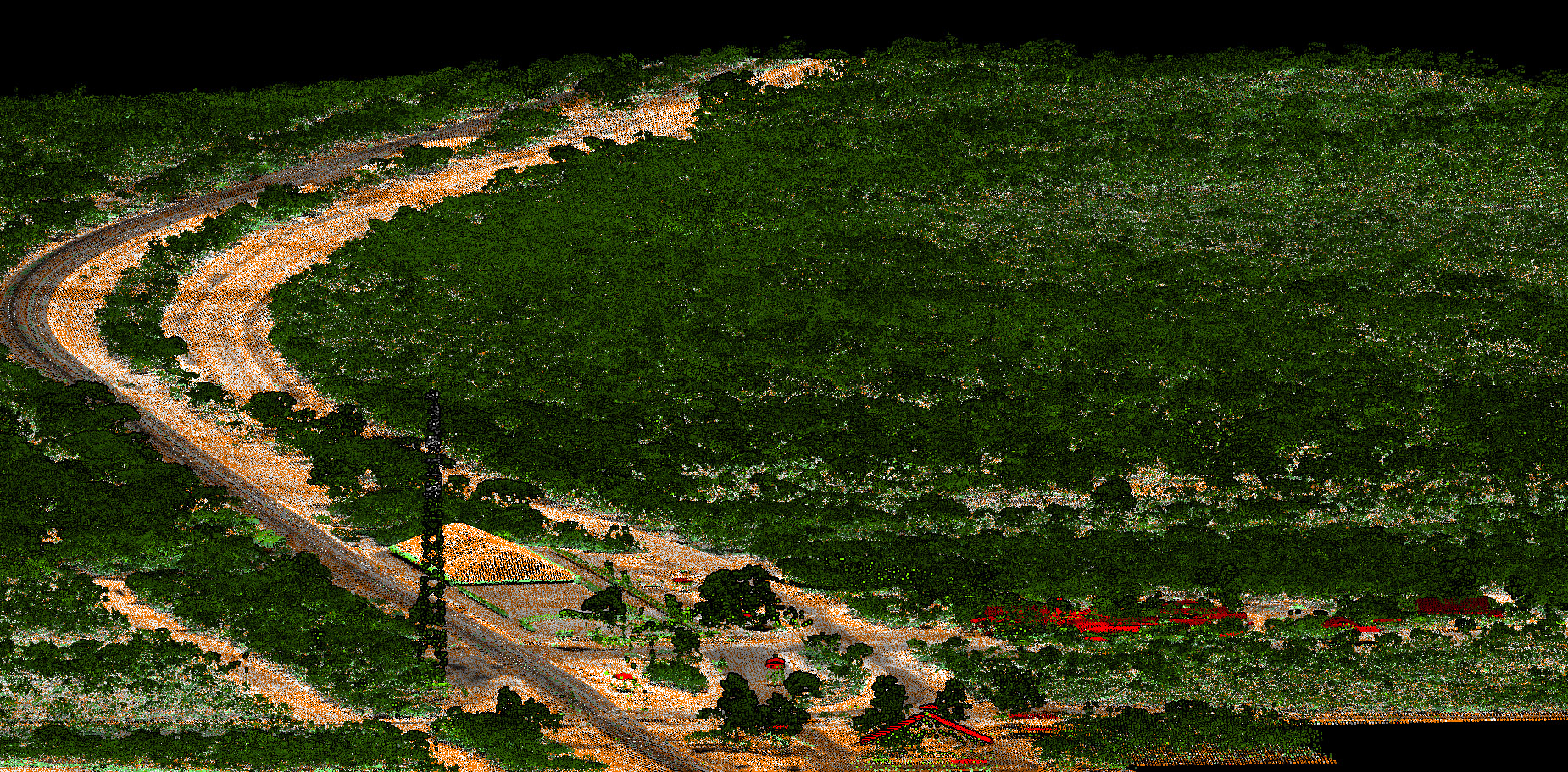
For many years MNG have been involved in various conservational based projects, entrusted with conducting aerial laser scanning (LiDAR) surveys throughout a number of remote areas across Australia. The most recent of which was carried out in the mid-west region of Western Australia to assist in the detection of Malleefowl mounds. In consultation with Anditi, MNG conducted an aerial laser scanning (LiDAR) survey over six key sites, with high resolution RGB imagery captured simultaneously with the LiDAR, to provide a greater detail of the landscape.
LiDAR is an unobtrusive method for data collection, causing no environmental impact. One of the primary benefits of utilising LiDAR for this project was the ability to see through vegetation and accurately map varying ground levels and variations across each site. Given the remoteness of the area, the use of LiDAR provided an efficient and reliable method of capturing data in the most cost and time efficient manner.
Mobilising from Jandakot Airport, MNG scanned each location using a series of flight runs of parallel alignments. With the remoteness of the area a factor, continuous flight tracking was maintained at all times to ensure the project was completed safely.
Following the safe and successful completion of the aerial survey, a colourised point cloud was delivered to Anditi. This will be used to form part of their comprehensive report and used to produce a Digital Elevation Model (DEM) for their client. Aerial photography supplied by MNG will be incorporated into the report, to further illustrate habitat and landscape context for the surrounding area. Using GPS coordinates, field researchers will be able to determine potential locations of nesting mounds at ground level, to confirm signs of activity and the condition of each nest.
Combining specialist experience with state-of-the-art technology, MNG take great pride in providing value-adding insights and innovative solutions to our clients. MNG have been involved in an array of innovative projects nationwide. You can read more about these, including the Malleefowl project, here: