MNG Access
East Metropolitan Health Service desktop study
PROJECT: Desktop Study for hospital location | Perth Eastern Region, Western Australia
CLIENT: Pricewaterhouse Coopers (PwC)
THE SITE
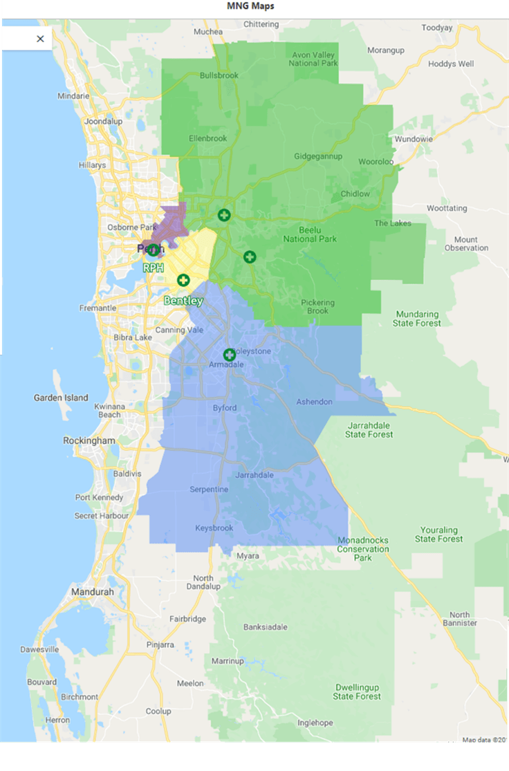
The East Metropolitan Health Service (EMHS) stretches over 3,500 square kilometres, encompasses 13 local government areas and serves a population of over 725,000 people in its catchment area.
Five hospitals collaborate to provide a combination of tertiary, secondary and specialist health care services including emergency and critical care, state trauma, elective and emergency surgery, along with numerous other medical services.
THE CHALLENGE
The Australian Bureau of Statistics (ABS) has forecast that population growth in the region will grow by over 25% in the next ten years, which will be critical to the delivery of ongoing services. Furthermore, understanding the demographic data across the EMHS region will ensure that the right care can be provided at the right time and right location.
The EMHS undertook a study for the Clinical Services Plan Towards 2024 (CSP) for the delivery of health care services in the EMHS region. The plan will guide the delivery of health care services in EMHS, ensuring they are responsive to the needs of the community.
A critical aspect of the project was the time frame in which it was to be completed, as the PwC team required a solution that could be operational in one week. This included data entry and product training to view the necessary datasets so that they could create their report for EMHS.
THE SOLUTION
MNG was engaged through PwC to provide a customised solution for a desktop study to analyse the statistical data of the region. Although much of the data readily existed with various government authorities including the Western Australian Government, Landgate, Western Australian Planning Commission and ABS, it was not easily accessible in one single solution.
CASE STUDY
MNG Access was selected as the platform due to its ease of use, web interface, mobile app accessibility and the fact it did not require exhaustive Geographical Information System (GIS) skills.
Utilising secure cloud-based technology, the online tool provides real-time project status updates from the convenience of any device, allowing transparent tracking of projects. An ideal solution for the PwC team, particularly given the restrictive time constraints.
PwC provided MNG with a list of requirements that would require customised layers to be created in MNG Access.
Metronet railway locations, district boundaries, State and Local Government land parcels, community activity centres and walkable catchment zones were all added to the custom data set, creating an accurate statistical data solution for PwC.
THE OUTCOME
The utilisation of MNG Access ensured all requirements were met and stakeholders were provided accurate information, in a format that allowed them to make informed decisions.
The effective project management tool possesses the ability to overlay layers with high-resolution aerial imagery in one simple format, providing additional integrity to the project visualisation.
This was particularly beneficial to PwC, enabling them to successfully deliver a detailed report to EMHS.