Laser Scanning (LiDAR)
Major road upgrades require unique skill sets for design
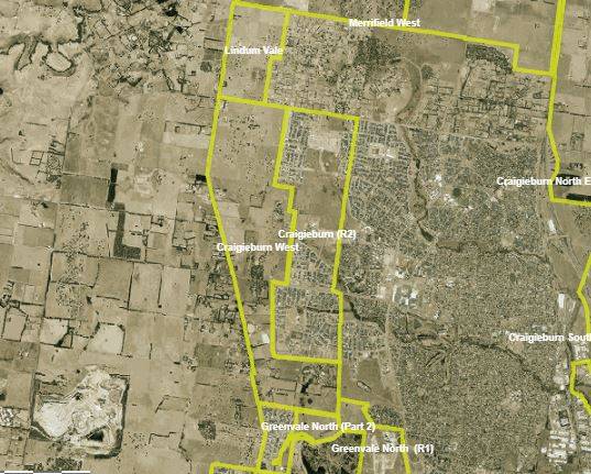
PROJECT: Craigieburn West Land Development | Craigieburn, Vic
CLIENT: Peet
PROJECT BACKGROUND
The Craigieburn West Precinct is located 32km north of Melbourne, within the Hume City Council and a key part of the Northern Growth Corridor.
The site is being developed by Peet – residential developers who plan and create communities, townhouses, and apartments. Craigieburn West Precinct is a significant parcel of land which will contain predominantly residential communities and open parklands.
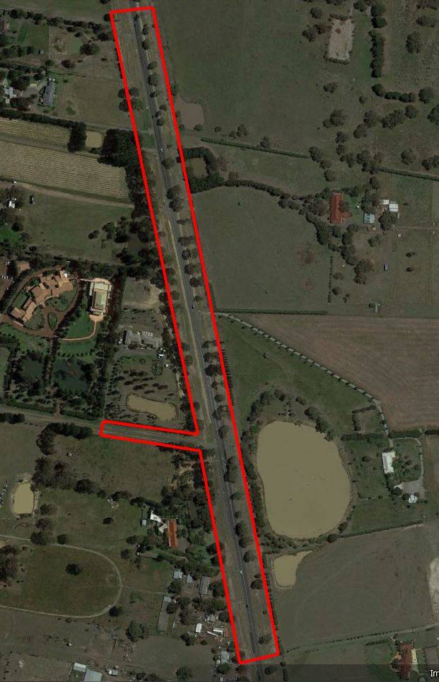
The Craigieburn West Precinct is adjacent to Mickleham Road – a busy, two-lane arterial road, leading the rapidly developing north to metropolitan Melbourne.
Peet required surveying works to support the design of two intersections on Mickleham Road to service the site and adjoining Aston community.
MNG was selected to provide these surveys.
CHALLENGES
The design of these major intersections required accurate and dense survey data of all features including the river red gum trees, extensive existing utility infrastructure, and road surfaces.
Due to tight project timelines, a rapid turn-around of survey data to support the engineering and drainage design was required.
The busy road could also not be easily accessed with traditional survey techniques, as any works on the road would have resulted in disruption to traffic.
SOLUTIONS
MNG proposed a mix of high-accuracy scanning solutions to provide a consolidated dataset for Peet.
At the commencement of the project, MNG captured Aerial Laser Scanning (ALS) and imagery over the surrounds to support future uses of this valuable spatial data. One use included 3D tree mapping to identify significant river red gum trees across the site.
To supplement the aerial survey, MNG used Terrestrial Laser Scanning (TLS) systems to capture dense point cloud data over the road surface, to combine with the aerial data.
Utilising ALS and TLS resulted in a significant reduction in time spent on site, which minimised traffic disruption and ensured surveyors could complete the works, safely.
OUTCOMES
MNG provided several innovative, holistic survey services to assist Peet with the design and construction elements of their Craigieburn West Precinct.
The detailed point cloud provided dense 3D spatial information on road surfaces and surrounding infrastructure. It also allowed for further interrogation and data mining, without the need to revisit the site to capture extra features.
In total, MNG delivered point cloud, aerial imagery, 3D and 2D CAD datasets and spherical imagery (like Google Street View). MNG’s approach meant the project was delivered safely and on time, in accordance with the tight timelines outlined by the client.
Supplying one complete and dense spatial dataset (as point cloud and extracted features), enabled the optioning of design concepts, scenario testing, and supported improved design outcomes for the client.