Innovative, bespoke surveying and spatial solutions that enable you to see your world more clearly than ever.


Innovative.
Adaptable.
Knowledgeable.
Over the last 30+ years, we’ve become one of Australia’s leading surveying and geospatial solutions providers by constantly innovating and evolving. By delivering increasingly accurate and rich geospatial information. By revealing critical insights that enable you to make better decisions. Spatial Modelling and Analysis using Real-time Technologies takes this to a new level, delivering precise detail in intuitive formats, fast.
High definition.
High accuracy.
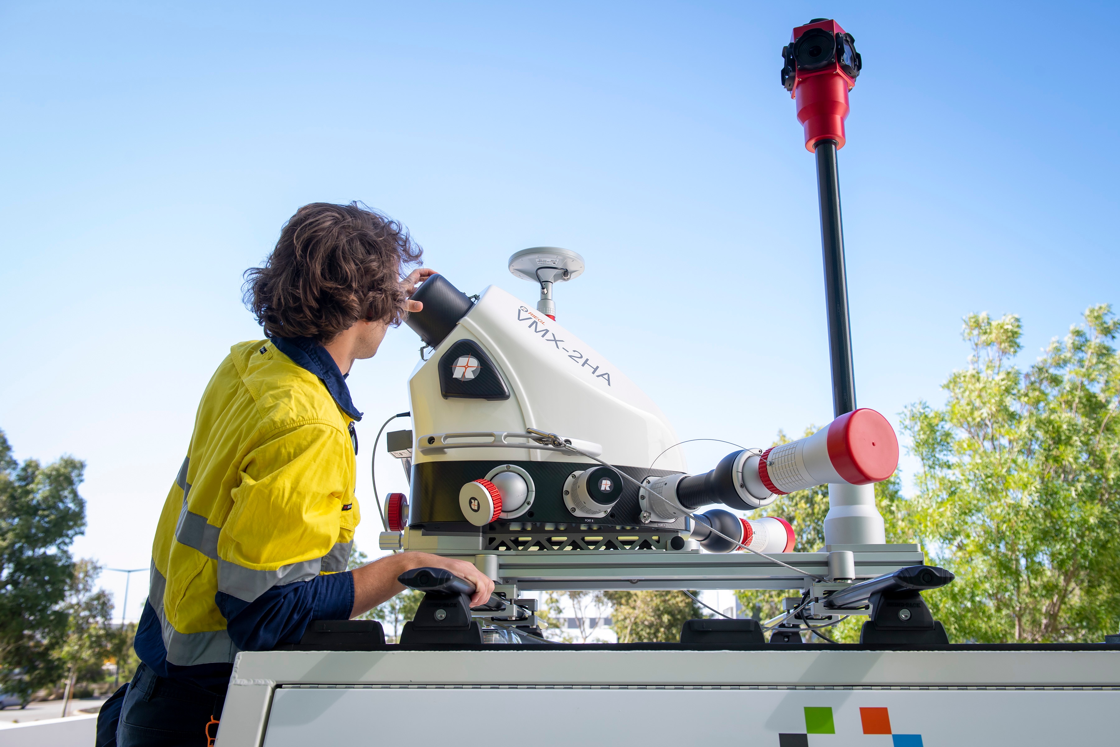
Drawing on over 20 years’ experience with LiDAR, we can capture virtually any environment using one or multiple systems to deliver information of unparalleled quality.
Visualising real-world data.
Using our vast array of scanners, we deliver real-world reality capture. We’re talking about true reality – digital models that are accurate in every detail, right down to surrounding vegetation.
What’s more, you can use a range of online platforms to view and share information and collaborate with relevant stakeholders.


Mobile Mapping.
Our mobile mapping solutions are game-changers for the Architectural Engineering Construction (AEC) market. HALO II enables us to create survey-accurate 3D geospatial twin models of complex buildings and structures, making detailed planning and design easier than ever.
Subsurface Modeller.
Vital underground utility services and assets are frequently intertwined and complex to understand. Strikes during excavation can be dangerous, expensive and cause costly delays. Subsurface Modeller gives you a clear 3D visualisation of each service, minimising or eliminating those risks.


Extended Reality.
Providing an instinctive method of mixing the real world with the virtual and digital world, Extended Reality enables you to immerse yourself in your project. Explore 3D spatial models, above and below ground, and take unnecessary uncertainty out of the design and planning processes.
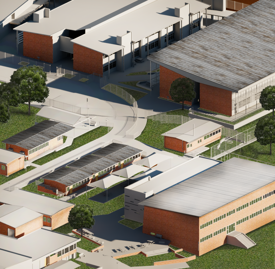
Digital Twins.
From a single object to an entire nation, we create digital twins by scanning and capturing all assets, buildings, infrastructure, vegetation and geological structures. A digital twin gives you a complete visualisation and understanding of the spatial world around you.
Moving from a 3D spatial model to a 4D temporal model, a digital twin even enables you to anticipate future needs. It empowers you to make informed decisions here and now and model different scenarios, minimising avoidable costs and delays today and into the future.
Take the next evolutionary step.
Discover how we can help you extract maximum value from your investment using our SMART surveying solutions.
