State-of-the-art (LiDAR) scanning technology featuring aerial, mobile, and terrestrial applications ready for rapid deployment across Australia. More than just a point cloud with our proven surveying and personalised services.


Aerial.
Terrestrial.
Mobile.
We’ve led the LiDAR surveying revolution in Australia for over 20 years. We have the hardware, software, deep technical knowledge and practical expertise all in-house to provide precise, detailed surveys. But most importantly, we listen. We’ll assess your requirements, closely working with you to build an accurate execution plan and provide fit-for-purpose outcomes.
Millimetre scanning precision. Millions of data points. One powerful dataset.
LiDAR, or Light Detection and Ranging, is a laser scanning technology that captures accurate 3D data of real-world environments. It works by firing rapid pulses of laser light at a surface and measuring the return time of each pulse. From those returns, the system builds a dense point cloud, a georeferenced collection with millions of precise 3D measurements, forming the foundation for topographic surfaces, 3D models and engineering-ready drawings.
At MNG, we process these point cloud datasets into 3D models and CAD (Computer-Aided Design) drawings, elevate them into BIM (Building Information Modelling) models, and keep them live as a Digital Twin. Every dataset we deliver is built to help your team move forward with clarity and confidence.
Fully integrated laser scanning.
Just as we offer an exceptional depth of technical LiDAR knowledge, we provide an unparalleled breadth of aerial, terrestrial and mobile laser scanning capability.
Richer value-adding information, imagery and insights providing even more time and cost-saving potential.
Our LiDAR Surveying Solutions.
Aerial Laser Scanning (ALS).
- Environmental impact studies
- Land development projects
- Terrain modelling and feature mapping
- Flora and fauna monitoring programs
- Flood studies and coastal mapping
- Infrastructure design, planning and mapping
Terrestrial Laser Scanning (TLS).
- Fast, safe and accurate LiDAR solutions
- High definition, minimal disruption
- Building Information Modelling (BIM)
- Engineering and asset management
- Scan-derived products in the format you require
Mobile Laser Scanning (MLS).
- Flexible, proprietary in-vehicle MLS system
- Safe: Zero traffic impact
- Unprecedented accuracy and efficiency
- 360° street-view visualisations
- Ideal for road and rail infrastructure projects
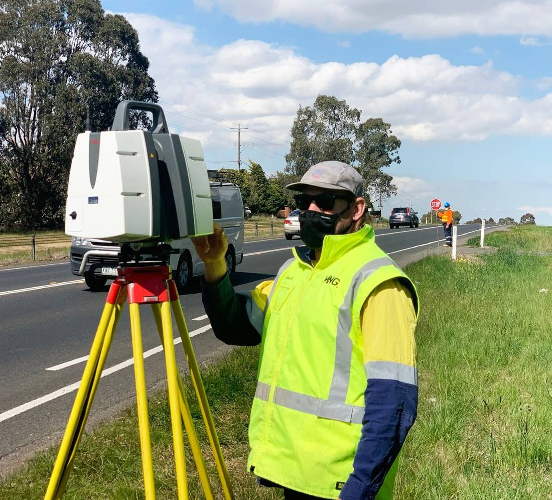
Terrestrial Scanning. Total Site Capture.
Ground-based and built for detail. Our terrestrial LiDAR scanning places high-powered sensors at fixed positions across a site, capturing every surface, angle and dimension within range. Each scan position stitches together into a single, unified point cloud with sub-millimetre accuracy.
One mobilisation. Comprehensive data. Our terrestrial scanning captures what would take traditional methods days in a fraction of the time, reducing site disruption and quickly sending verified, accurate data back to your project team.
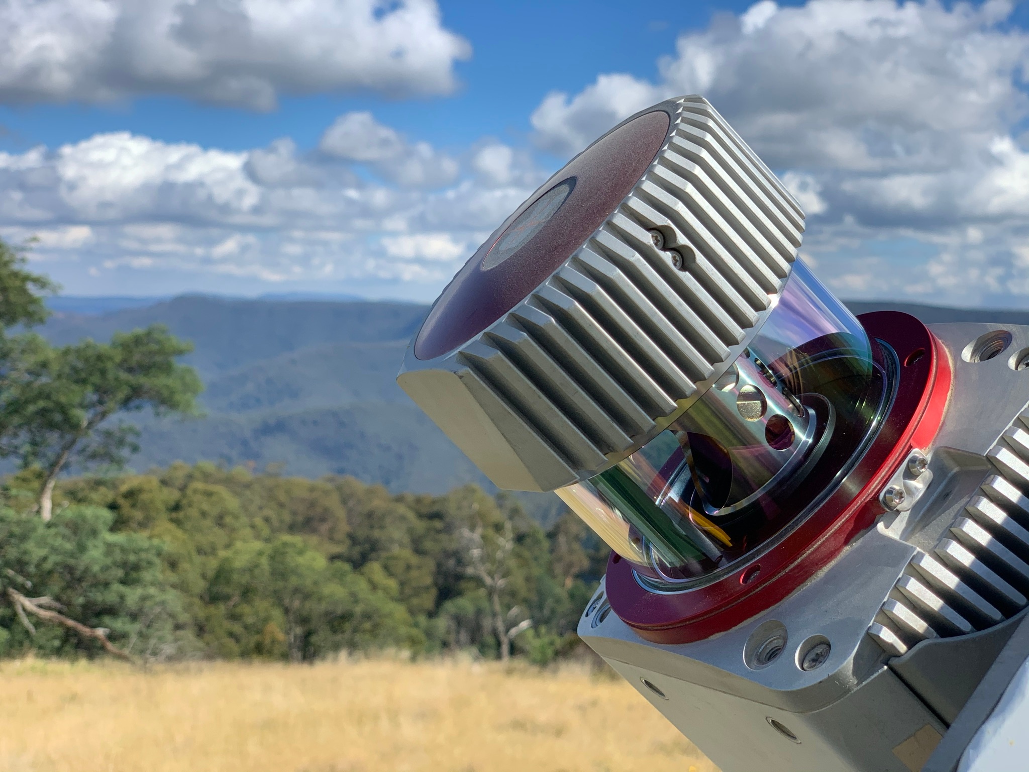
Aerial LiDAR Survey at Landscape Scale.
When the project demands scale, we take to the air. Our aerial LiDAR surveying mounts high-powered sensors onto drones and aircrafts, conducting precise LiDAR surveys across vast areas that ground-based methods simply can’t cover efficiently. Every flight path is georeferenced in real time, producing dense, accurate point cloud datasets across entire landscapes in a single campaign.
What sets aerial LiDAR apart is its ability to penetrate dense vegetation and return the bare earth beneath. Open corridors, coastal environments or heavily vegetated land, these drone surveying capabilities are critical for terrain modelling, drainage analysis and infrastructure planning that ground teams can’t reliably deliver alone.


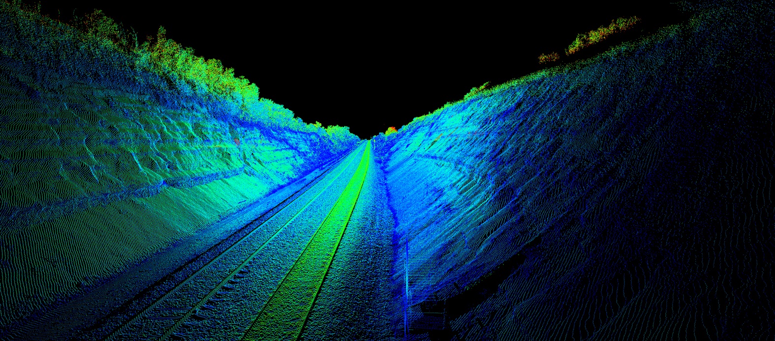
3D Mobile Laser Scanning. Every Kilometre Captured.
Our mobile laser scanning mounts LiDAR sensors onto vehicles, rail trolleys and vessels, capturing continuous point cloud data across entire routes in a single pass. Road and rail corridors, utility networks, tunnels and bridges. All captured accurately, without closing a lane or stopping a train.
A road corridor that would take a ground crew days can be completed in hours. That data feeds directly into asset condition assessments, clearance analysis and infrastructure planning, naturally helping your team manage and maintain assets with confidence.
How can our LiDAR experts help you?
Tap into our market-leading aerial, terrestrial and mobile LiDAR scanning solutions. Our team has helped a range of Australian companies across various industries, providing rich datasets that drove actionable outcomes. Tell us about your project and visualisation requirements today.
