Real-Time Land Insights,

All in One Place

MNG Access is a comprehensive, cloud-based platform developed by  MNG to provide real-time access to spatial and land parcel data. It’s designed to support professionals in land development, engineering, planning, sales and related sectors by offering intuitive tools for data visualisation, analysis, and constraints mapping.

Get started

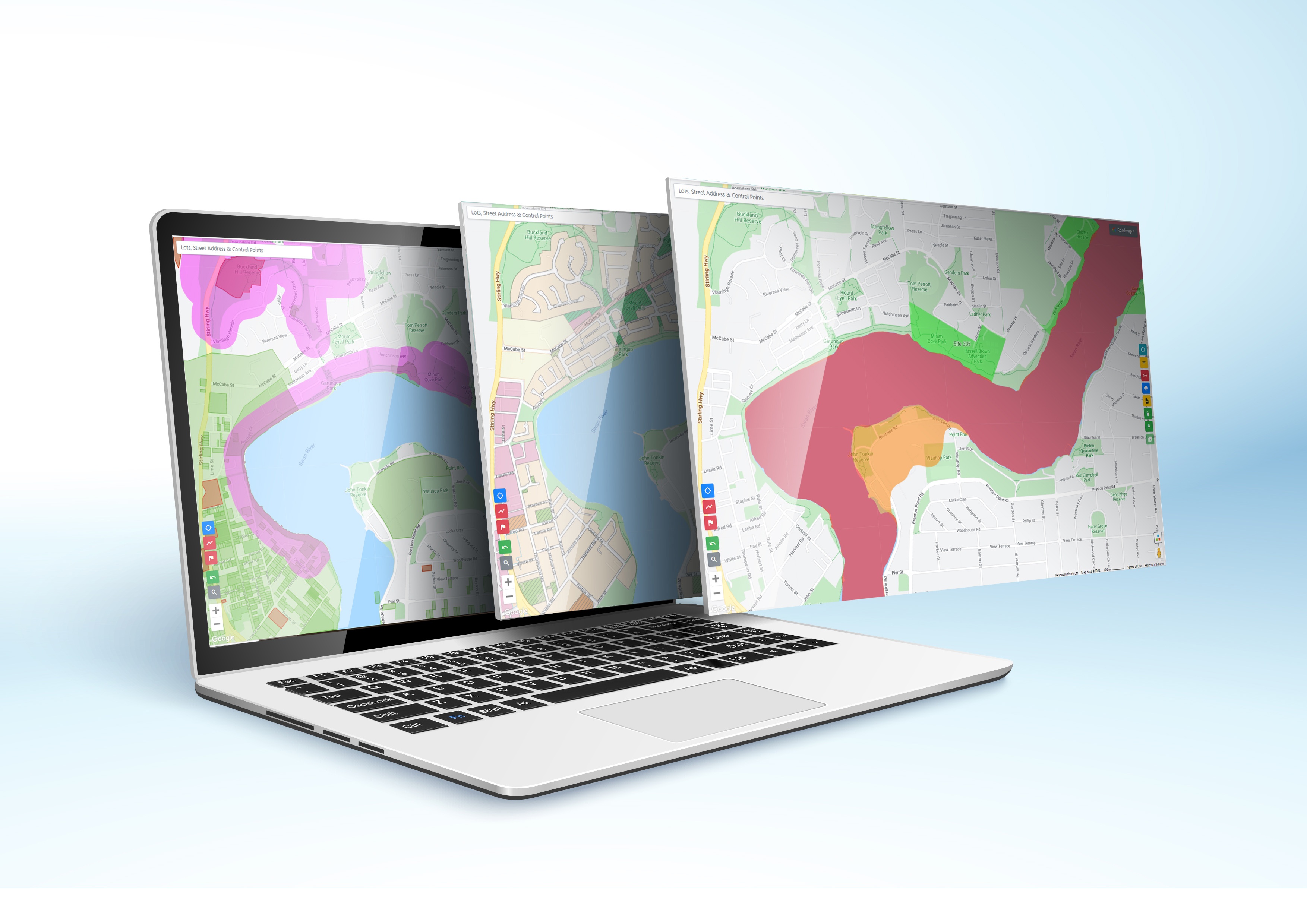
Multi-Layered Mapping & Visualisation

MNG Access allows users to view and analyse spatial data with precision. High-resolution aerial imagery, cadastral boundaries, and planning overlays can be combined to build a comprehensive understanding of any site.

Real-Time Data Access & Project Tracking

The platform provides immediate access to up-to-date project information, helping teams monitor the status of land titles, approvals, and survey deliverables.

MNG Access

Interactive Tools for Analysis

MNG Access includes built-in tools that allow users to interact with spatial data directly. Users can measure distances, calculate areas, and annotate maps with notes and markups to support collaborative planning.

Mobile Accessibility

Designed with field teams in mind, MNG Access is fully accessible on smartphones and tablets. The platform supports real-time GPS location tracking, enabling teams to work confidently on-site with accurate spatial reference.

MNG Access

Subscription-Based Modules

MNG Access offers flexible subscription tiers to suit different project and business needs.

Collaboration & Communication

The platform is designed to support teamwork and communication. Users can share annotated maps, project documents, and insights with other stakeholders directly through the platform.

MNG Access

Additional Features

Integration with Google Maps and satellite imagery for enhanced context and ease of navigation.

Capability to view, print, forward, and download project information with personalised company logo featured on plans.

Desktop and mobile access ensures flexibility across different work environments.

GIS customisation to create bespoke job layers for project specific needs such as heatmaps, plan overlays, dwelling counts etc.

Want information at your fingertips?

Speak with our experienced team to find out what we can do for your business and projects.

Contact us