Aerial Surveying, Engineering Surveying, Geospatial Data Management & Analysis, Laser Scanning (LiDAR)
Integrating airborne and ground surveys to deliver cost benefits
PROJECT: Tonkin Highway extension | Serpentine WA
CLIENT: Main Roads Western Australia
PROJECT BACKGROUND
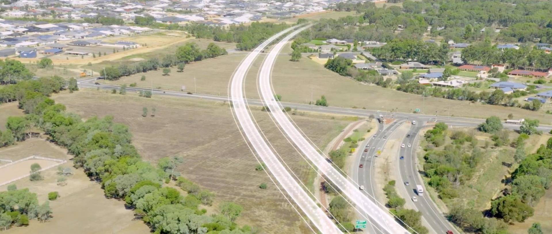
The Tonkin Highway is a 50km north-south highway running along the eastern corridor of the greater Perth metropolitan area. The south-east corridor is an important and fast-growing area faced with increased congestion, higher travel times for freight vehicles, and reduced safety outcomes on the existing road network. Perth’s growing population will put significant pressure on the existing road network with volumes exceeding recommended capacity.
Federal and State Governments have committed over $500 million to an infrastructure project – the Tonkin Highway Extension – which will extend the Tonkin Highway approximately 14km, as a four lane, dual carriageway further south to connect with the South Western Highway. This will also include a shared path along the corridor.
The project scope also includes consideration of the Kwinana South Western rail line realignment between Bishop Road, and the Perth to Bunbury rail line south of Mundijong Road.
To commence the design phase for the extension of Tonkin Highway south, Main Roads Western Australia (MRWA) required an accurate topographical survey model across 7,500ha. MNG proved the ideal company to provide this support.
CHALLENGES
The cost and the time to survey such a large area using conventional survey techniques across mixed use land sites posed a significant challenge to the project. This was due to the potential of ground survey works across private property, challenging environments, and extensive area of roads and highways, which would require many weeks of effort.
SOLUTIONS
MNG proposed a mix of high accuracy Aerial Laser Scanning (ALS) and Mobile Laser Scanning (MLS) solutions to provide dense coverage over the 14km route.
Using a crewed aircraft with the ALS and Camera System eliminated the need for surveyors to enter private property, which provided significant time, cost and safety benefits.
A significant benefit of the ALS was the quick and discrete data capture which enabled broad coverage to provide dense spatial data over the proposed road corridor. ALS was captured across a two-day program following calibrations. Aerial photography was simultaneously captured at a pixel size of 7cm to produce an orthophoto of the project area.
The aerial survey was enhanced by MNG’s purpose-built MLS survey system, Cirrus-1. The MLS was used to quickly and safely capture a high-accuracy point cloud for a feature survey along accessible roads in the project area. Cirrus-1 conducted multiple passes along a series of accessible roads within the project site in a single day. Data extraction of the combined ALS and MLS point cloud included edge of bitumen, kerb lines, road shoulder and above ground services and furniture etc.
The final digital ground survey model is a combination of manually extracted features within MLS corridors and automated ALS ground mesh.
OUTCOMES
MNG integrated the ALS and the MLS to provide MRWA with the point cloud data, modelled feature data, contours, ortho-mosaic aerial imagery and various reports.
The combined project point cloud was classified and provided a rich visualisation of the project area and surrounds for use by MRWA. This information would support of various assessments, in the planning, design and development of the Tonkin Highway Extension.